When you buy or own land, you need clear proof of what belongs to you and where your property lines lie. A boundary survey and a title report both give you important details, but they answer very different questions. A boundary survey measures and marks the land itself, while a title report looks at legal records to show who has held ownership over time. Neither one replaces the other, and understanding what each does helps you make smart choices for your property.
Many people think these documents do the same job, but they serve separate purposes. Knowing the difference keeps you from making wrong assumptions and helps you avoid problems later.
Understanding the Different Jobs of a Boundary Survey and a Title Report
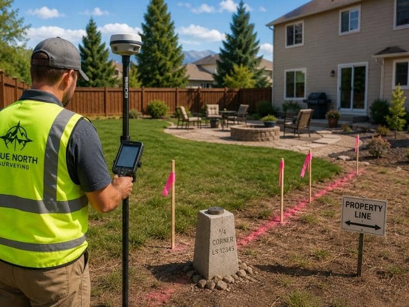
Each document follows a different process and serves a specific goal. A boundary survey involves going to the site, taking measurements, and mapping the exact shape and size of the land. It shows where lines fall on the ground, where corners sit, and what features exist within the limits. A title report searches through public records to trace past transfers, rights, and restrictions attached to the property.
To see how they compare, look at these basic differences:
- A boundary survey focuses on physical facts on the land
- A title report focuses on legal history written in documents
- One tells you where your property sits, and the other tells you what rights come with it
These two tools work together, but they do not overlap in what they provide. You cannot use a title report to stake out a fence line, just as you cannot use a survey to prove who owned the land 50 years ago.
Following the Paper Trail Versus Verifying Conditions on the Ground
Records kept in county offices describe land using words and numbers written long ago. A title report gathers these descriptions, lists past owners, and notes any claims or agreements that affect the property. It follows the paper trail without visiting the actual site.
A boundary survey does the opposite. It starts with those same records but then checks what exists today. Surveyors look for old markers, fences, roads, and changes in the land. They compare what is written to what they find standing there. This physical check often reveals details that papers alone cannot show. You can use land boundary verification to confirm if the real world matches the written description.
When Property Ownership Documents and Site Conditions Don’t Match
Sometimes the legal description in records does not fit what you see on the ground. This happens for many reasons. Property lines may have been marked roughly decades ago, and those marks shifted or disappeared over time. Fences or buildings might have been placed by guesswork, and they sit across the actual boundary. Natural changes like erosion or tree growth can also alter how the edge of the land looks.
Incomplete or old records add to this confusion. Deeds written many years ago may use vague terms such as “along the old road” or “near the large oak tree.” Over time, roads change and trees fall, leaving no clear reference point. When records and reality do not line up, you need both types of information to sort out the true limits and rights of the property.
Why Real Estate Professionals Often Review Both Before Major Transactions
Buyers, sellers, lenders, and legal advisors all rely on these documents, but they use them for different reasons. A lender looks at the title report to confirm there are no unpaid debts or claims that could affect the loan. An attorney reviews both to make sure the sale follows legal rules and that the buyer knows exactly what they are getting. A builder or architect needs the survey to know where they can safely build.
Each professional brings a different focus, but they all benefit from seeing the full picture. Using only one document leaves gaps. You might know who owns the land but not exactly where it ends, or know where the lines sit but not what rights come with the land. Combining both gives you a complete view of the property’s legal and physical status. This combined review helps you avoid surprises and build confidence in every decision. You can rely on property record comparison to make sure nothing important gets missed.
Choosing the Right Information for Your Property Goals
The document you need depends on what you plan to do. If you want to build a fence, add an extension, or start construction, you need a boundary survey to mark the exact limits. If you are buying land, taking out a loan, or checking ownership history, a title report shows you the legal background.
For most major actions, using both gives you the strongest position. You know the physical space you control, and you know the legal rights that come with it. This combination helps you manage the property well, plan improvements, and protect your investment over time. You do not have to choose one over the other, but you do have to understand which one answers your specific question.
Frequently Asked Questions
Can a title report identify the exact location of a property’s legal boundaries?
No. A title report uses written descriptions but does not measure or mark the land. It tells you what the records say, but it does not confirm where lines sit on the ground.
Does a Boundary Survey change who legally owns a property?
No. It only shows the location of the boundaries based on records and physical evidence. It does not transfer ownership or rewrite legal rights.
Why do lenders and title companies request different property documents during a transaction?
Lenders want proof of clear ownership and no outstanding claims, which the title report provides. Title companies use surveys to confirm the property matches what is described and to see if any structures cross boundaries.
Can a Boundary Survey uncover information that is not included in a title report?
Yes. It reveals physical features such as misplaced fences, overgrown lines, or changes in the land that old documents do not mention.
When should a property owner obtain both a Boundary Survey and a title report?
You should get both when buying land, planning construction, refinancing, or updating estate plans. They work together to give you a full understanding of the property.
Who prepares a title report, and who performs a Boundary Survey?
A title professional or abstract company prepares the title report. A licensed land surveyor completes the boundary survey, using their training and tools to measure and map the site.