

↓
 

Carrollton Land Surveying

...serving the Carrollton, Georgia & Carroll County area...

Carrollton Land Surveying
  • Home
  • ALTA Title Survey
  • Boundary Surveying
  • Construction Survey
  • Drone LiDAR Mapping
  • Elevation Survey
  • Land Surveying
  • Lot Survey – Mortgage Survey – Closing Survey
  • Topographic Survey
  • Blog
  • Contact Us
Home - Page 3 << 1 2 3 4 5 … 12 13 >>

Post navigation

← Older posts
Newer posts →

Understanding Table A Options in an ALTA Survey

Carrollton Land Surveying Posted on August 27, 2026 by Carrollton SurveyorAugust 26, 2026
Land surveyors conducting an ALTA survey while clients review property documents at a commercial property in Carrollton, GA.

An ALTA survey has a menu, and most buyers never read it. That menu is Table A, and it decides how much your survey actually tells you. Pick the right options and the survey answers the questions your deal depends on. Pick blindly and you pay for detail you don’t need, or worse, miss detail you do. For a developer, knowing Table A is how you get a survey built for your project instead of a generic one.

Table A Options Show Which Extra Details an ALTA Survey Will Document

Every ALTA survey follows a shared set of national standards. Those standards cover the basics, like boundaries and title matters, on every job. Table A is the part you choose from.

It’s a list of optional items a buyer can add to the survey scope. Each one tells the surveyor to go document something extra. Without a Table A selection, you get the standard survey and nothing more. Add items, and the survey grows to match your needs.

Think of the base survey as the frame. Table A is what you hang on it. The options can pull in things like site improvements, utilities, parking counts, flood data, and building measurements. You decide which ones belong on your survey before the work starts. That single choice shapes how useful the final drawing turns out to be.

Different Table A Choices Answer Different Property Due-Diligence Questions

Each Table A item exists to answer a specific question about the property. The trick is matching the option to the question you actually have.

Some options deal with what sits on the site:

  • Improvements like buildings, walls, and paving and where they sit
  • Parking spaces and a count of them, which matters for commercial use
  • Building dimensions, height, and square footage
  • Utility locations based on markings and available records
  • Flood zone information tied to published federal maps

A buyer worried about parking ratios cares about the parking count. A lender checking flood risk wants the flood item. A developer planning around underground lines needs the utility option. Same survey, different questions, different Table A picks. You choose the items that map to the risks and plans in front of you. Skip the ones that don’t apply, since each item adds time and cost.

The Right Options Depend on What the Buyer Plans to Do With the Property

There’s no universal Table A list. What you select should follow what you plan to do with the land. A holding investor and a ground-up developer need different things from the same parcel.

A developer planning to build wants utilities, improvements, and site detail that inform design. A lender wants the items that protect the loan, like flood data and clear improvement locations. An investor reviewing risk may want a lighter scope focused on title-related concerns. A commercial buyer keeping the existing building might care most about parking and zoning-related items.

Financing drives some of these choices too. Lenders often hand you a required list of Table A items as a loan condition. If that’s your situation, start there, then add anything your own plans call for. The point is to match the survey to the deal. A redevelopment project and a simple purchase shouldn’t order the same scope, because they’re answering different questions.

Surveyors Need Clear Instructions Before Fieldwork Begins

A surveyor can only document what you ask for before they head to the site. Decide the Table A scope late, and you risk a second trip or a gap in the survey. Decide it early, and the crew collects everything in one pass.

The best starting point is the title commitment. It lists the easements and exceptions the survey should locate and address. Reviewing it with the surveyor up front helps them plan the fieldwork around real title issues, not guesses.

Your project requirements come next. Tell the surveyor what you’re building or buying, and share any list your lender required. With the title commitment, your goals, and the selected Table A items in hand, the surveyor knows exactly what to capture. That clarity keeps the job efficient and the final survey complete. Vague instructions produce a vague survey, and then you’re paying for revisions.

A Well-Chosen Table A Scope Makes the Survey More Useful for Due Diligence

Table A works best when you treat it as a set of choices, not a box to check. A thoughtful selection turns a standard survey into a document built around your actual transaction. A careless one leaves you with detail that doesn’t fit the deal.

Match the options to the property’s real goals. Order what your financing, your build plan, and your risk review actually need. Leave off what doesn’t apply so you’re not paying for extra fieldwork with no payoff. The result is a survey your title company, lender, and design team can all use.

Talk through the options with your surveyor before the order is final. A short conversation about your plans lets them recommend the items that fit. Get the scope right at the start, and the survey earns its cost during due diligence instead of leaving you with questions it was never asked to answer.

Frequently Asked Questions

What is Table A in an ALTA survey?

Table A is the optional list of items a buyer can add to an ALTA survey. The base survey covers standard boundary and title matters, and Table A extends it. Options can include improvements, utilities, parking counts, flood data, and building dimensions. You choose which items the surveyor documents based on your project needs.

Which Table A options do lenders usually require?

It varies by lender and deal, so there’s no fixed list. Flood zone information and clear improvement locations are commonly requested. Some lenders also ask for utilities and parking details. Always get your lender’s required Table A list early, then add any items your own plans need.

Do more Table A items cost more?

Yes, each option adds fieldwork, research, or both, which raises the price and can extend the timeline. That’s why picking only the items that fit your project matters. Ordering everything wastes money on detail you may never use. A focused selection keeps cost tied to real value.

When should I choose my Table A options?

Choose them before the surveyor begins fieldwork, ideally right after you review the title commitment. Early selection lets the crew capture everything in one visit. Deciding late can force a return trip or leave gaps in the survey. Share your plans and any lender list with the surveyor up front.

Posted in ALTA Title Survey | Tagged ALTA Survey, ALTA Title survey

Construction Surveyors and Why Contractors Depend on Accurate Layouts

Carrollton Land Surveying Posted on August 25, 2026 by Carrollton SurveyorAugust 25, 2026
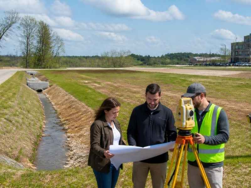
Construction surveyors in Carrollton, Georgia, using a total station for accurate site layout and staking.

A set of drawings is a plan, not a position. Construction surveyors are the people who turn that plan into exact spots on the dirt. They mark where the foundation goes, where the utilities run, and where every corner lands. Without that work, a crew is guessing, and guessing on a job site gets expensive fast. Get the layout right, and everything built on top of it has a solid start.

Construction Surveyors Put the Design Into the Exact Positions Crews Need

Drawings show what to build. They don’t show where it sits on the actual ground. Those are two different problems, and the gap between them is where surveyors come in.

A design lives on paper in feet and inches. The site is real dirt with slopes, curves, and edges. Someone has to move the plan from one to the other with precision. That’s the surveyor’s job.

They start with control points, which are fixed positions tied to known coordinates. From those points, they measure out every planned feature and mark it on the ground. Building corners, grid lines, utility runs, road edges. Each one gets a physical spot the crew can see and trust. A contractor working off marked positions builds with confidence. A contractor scaling a drawing by eye builds a problem.

Layout Points Give Crews a Reliable Reference Before Work Covers the Site

Once the site work starts, the ground changes fast. Dirt moves, trenches open, concrete goes down. The surveyor sets references before all that happens, so crews always have something to measure from.

These references come in a few forms:

  • Stakes that mark a corner or a line
  • Hubs and tacks that fix an exact point
  • Offset stakes set a safe distance from the real spot so they survive the digging
  • Control points that tie the whole site to one coordinate system
  • Grade marks that show the right height

Crews use these to find building corners, column grids, pipe runs, curbs, and road centerlines. The offset stakes matter more than people expect. You can’t put a stake right on a footing and expect it to last, so the surveyor sets it back a known distance. The crew measures over from there. It’s a simple trick that keeps the reference alive once the machines start moving.

Small Position Errors Can Create Problems Across the Rest of the Project

A site layout error rarely stays small. It travels. A foundation set a few inches off pushes the walls off, which pushes the roof line off, and the mistake grows as the building rises.

Picture a foundation placed too close to a property line. Now the setback fails, and the whole structure may need to move. Or a utility stub comes up in the wrong spot, and the pipe that was supposed to meet it doesn’t. Elevations are just as unforgiving. A pad set too low can leave water sitting where it shouldn’t.

The trouble is connections. Buildings, utilities, roads, and grades all have to meet at planned points. One piece in the wrong place throws off everything it connects to. Fixing a layout error after concrete is poured costs far more than getting the stake right the first time. Accurate construction surveyors are cheap compared to tearing out a wall.

Survey Control Helps Crews Keep New Work Aligned as Construction Moves Upward

Layout isn’t a one-time visit. As the project rises, the crew needs fresh references at each stage. The surveyor keeps providing them, both side to side and up and down.

Horizontal control keeps everything lined up on the plan. Vertical control keeps every elevation correct, from the footing depth to the finished floor. These two together let a crew place a foundation, then a wall, then a curb, and know each one sits where it should.

The site keeps changing, so the references have to keep coming. After the foundation, the surveyor may lay out structural points. Then curb and gutter lines. Then paving grades. Each phase builds on verified positions instead of a stake someone bumped three weeks ago. That steady stream of control is what keeps a growing project honest. Skip it midway, and small drifts start stacking up.

Accurate Construction Layout Gives Contractors Confidence Before They Build

Good layout changes how a contractor works. Instead of hoping the drawings translate to the ground, they build from positions a surveyor verified. That confidence shows up in the schedule and the budget.

Verified control also catches problems early. If the design and the site don’t agree, the surveyor often spots it during layout, before any concrete locks the mistake in place. That’s the cheapest possible time to fix a conflict. A discrepancy caught on the stake is a phone call. The same discrepancy caught after framing is a change order.

Bring the surveyor in early and keep them through the phases. Dependable layout means fewer surprises, fewer reworks, and a crew that isn’t standing around waiting to find out if they built it right. For a developer watching cost and timeline, accurate layout is one of the safest bets on the whole job.

Frequently Asked Questions

What does a construction surveyor actually do on site?

A construction surveyor transfers the approved design onto the real ground. They set stakes, hubs, and marks that show crews where to place foundations, utilities, roads, and other features. They also provide height references for correct elevations. Their work gives the crew exact positions to build from instead of estimates.

What is the difference between layout and construction staking?

The two terms overlap and are often used together. Staking is the act of placing stakes and marks that show planned positions on the ground. Layout is the broader work of transferring the full design to the site using those stakes and control points. Both aim to put the crew on the correct spots.

What are offset stakes and why do surveyors use them?

An offset stake sits a known distance away from the true point, not right on it. Crews can’t build over a stake set directly on a footing, and digging would destroy it. So the surveyor places it back a measured distance and the crew measures over. This keeps the reference usable once work begins.

How often does a surveyor return during construction?

That depends on the project size and its phases. Many jobs need the surveyor back for each major stage, such as foundation, structure, curbs, and paving. Each phase needs fresh horizontal and vertical control. Regular visits keep new work aligned as the site changes and prevent small errors from stacking up.

What happens if the construction layout is wrong?

An error in layout can spread through the whole project. A misplaced foundation can throw off walls, utilities, setbacks, and elevations that all connect to it. Fixing these problems after concrete is poured is costly and slow. Accurate layout from the start is far cheaper than correcting a mistake later.

Posted in construction survey | Tagged construction survey

Land Surveying and Site Planning: Why Early Measurements Matter

Carrollton Land Surveying Posted on August 20, 2026 by Carrollton SurveyorAugust 18, 2026
Land surveyor, developer, and engineer in Carrollton GA reviewing site measurements, drainage, access, and terrain before finalizing development plans.

Most site plans go wrong before the first shovel. The design gets drawn, the budget gets set, then the real measurements show up and none of it fits. Land surveying done early flips that order. It puts accurate site facts in front of the design team from the start, so the plan is built on the real property instead of a rough idea of it. Measure first, and the whole project rests on solid numbers.

How Do Early Site Measurements Help With Development Plans?

Accurate site information should come before the plans are final. You want the real numbers in hand while the design is still open. Collect them late, and you risk drawing a plan the site can’t hold.

Early measurements give designers a clear view of the land. They see the true shape, the real distances and the features already there. That beats working from an old drawing or a guess. A design built on current facts starts closer to what the site can actually support.

The point is to decide with current information. Site planning runs on a stack of choices about where things go. Each choice is only as good as the data behind it. Fresh measurements make those early calls sound instead of shaky.

What Site Details Should Be Measured Before Planning a Project?

A good early survey captures the details that shape the plan. It covers more than the boundary. It records what’s on the ground and how the land sits.

Measure these before you plan the project:

  • existing buildings and structures
  • driveways, parking and other paved areas
  • access points and entrances
  • ground features like slopes, high spots and low areas
  • drainage paths and other conditions tied to the work

Each measurement helps show how the project fits the site. The building footprint has to land in real open space. The access has to work with the real entrances. The grading has to respect the real slopes. Measured facts let the design meet the ground.

This isn’t about survey definitions. It’s about giving the plan the site details it needs. A project that changes the grade needs elevation data. A tight infill site needs exact distances. Match the measurements to what the job depends on.

How Can Early Survey Data Reduce Changes to Site Plans?

Early survey data cuts the rework that eats budgets. Designers use the measurements before they lock the layout. They test where things go against the real site, then commit. That order keeps the plan from crashing into facts later.

The data catches conflicts while they’re cheap to fix. A building placed over a drain line shows up on the drawing, not in the field. A drive that clips a slope gets caught at the desk. Each conflict spotted early is a change made on paper instead of a stop-work order on site.

Rework is where projects bleed time and money. A plan built on bad or missing data gets redrawn once the truth surfaces. A plan built on early measurements holds up. Fewer redraws mean a cleaner path from design to construction.

Why Should Developers Use Survey Information Before Finalizing Site Plans?

Survey information supports the big calls a developer makes. Where does the building sit? How much of the site is usable? Does the layout fit the access and the grades? Accurate data answers those questions before the plan is set, not after.

It also keeps the whole team aligned. Architects, engineers and the developer all work from one accurate picture of the site. When everyone shares the same measurements, their plans line up. When they don’t, the drawings clash and someone pays to reconcile them.

There’s a cost and schedule angle too. Early survey data helps a developer plan the budget and the timeline with fewer unknowns. You price the work against real conditions. You set the schedule around facts, not hopes. A surprise found after the plan is locked can blow both. Early measurements shrink that risk.

When Should Land Surveying Be Completed During Site Planning?

Get the survey done early enough to shape the design, not confirm it. The right stage is before the layout is chosen, while the plan can still bend around what the survey finds. Survey after the design is set, and the data can only tell you what’s already wrong.

Think of the survey as the first real step in planning. The team collects the site facts, then designs them. That sequence lets the measurements steer the plan from the start. It also gives you time to sort any issue the survey turns up before the schedule tightens.

Timing protects the budget as much as the design. A survey booked early fits the plan at a normal pace and cost. A survey rushed in late, after a conflict surfaces, costs more and buys less. Order it near the front of planning, and the whole project moves on steadier footing.

For a developer planning a project, early land surveying sets the tone for everything after it. You start with facts. You design the real site. You hand your team and your budget a plan that matches the ground. That head start is what keeps a project from unraveling once the work begins.

Posted in land surveying | Tagged Carrollton land surveying, Land Surveying, land surveying Carrollton

Post navigation

← Older posts
Newer posts →
Get Quote Button
© Boxer Survey USA
CarrolltonLandSurveying.com

Carrollton, Georgia
Phone: (470) 729-1411

Web Development and SEO by:
AuburnBusiness.com, LLC


Privacy Policy | Terms of Use

The owner of this website, Boxer Survey USA, provides coordination of professional land surveying and engineering services in all 50 states. The professional surveying and engineering services provided to you will be conducted by fully licensed professionals in your state.

Privacy
↑