↓
 

Carrollton Land Surveying

...serving the Carrollton, Georgia & Carroll County area...

Carrollton Land Surveying
  • Home
  • ALTA Title Survey
  • Boundary Surveying
  • Construction Survey
  • Drone LiDAR Mapping
  • Elevation Survey
  • Land Surveying
  • Lot Survey – Mortgage Survey – Closing Survey
  • Topographic Survey
  • Blog
  • Contact Us
Home - Page 2 << 1 2 3 4 … 7 8 >>

Post navigation

← Older posts
Newer posts →

Protect Your Investment: Why Every Commercial Property Needs an ALTA Survey

Carrollton Land Surveying Posted on July 1, 2026 by Carrollton SurveyorJuly 1, 2026
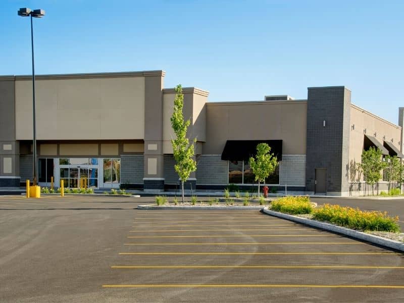
Commercial property exterior with parking lot layout used for ALTA survey analysis and site evaluation for real estate investment planning.

Purchasing commercial property is a major decision, and it affects your business for many years to come. You need more than just a look at the building or a quick review of old documents. An ALTA survey gives you detailed, accurate information about the entire site, and it helps you see exactly what you are buying before you sign any final papers. This information acts as a reliable guide to make sure the property fits your plans and holds its value over time.

Every business uses space in different ways, and what works for one company may not work for another. Understanding the full layout and limits of the land keeps you from running into surprises later that could slow growth or raise costs.

Every Commercial Property Has a Different Business Purpose

Commercial properties serve many different goals, and each type has its own set of needs. A retail store needs easy access for customers and enough room for parking. A warehouse requires wide turning paths for trucks and space for loading and unloading goods. Office buildings need clear walkways and areas for employees to gather. Medical facilities require extra space for parking and separate zones for patient traffic.

Even within the same area, no two properties offer exactly the same conditions. The size, shape, and location of the land change how you can use it. An ALTA survey collects all these details into one clear report, so you can compare the property against what your business actually needs. It turns vague ideas about space into clear facts you can rely on.

Looking Beyond the Building to Evaluate the Entire Property

Most buyers focus first on the walls, roof, and interior of the building. However, the land around the structure plays just as big a role in daily operations. You have to think about how vehicles move through the lot, where people walk, and how deliveries reach the right doors. You also need to check how much open space remains and whether utilities can support your current and future needs.

Key details to consider include:

  • Size and layout of parking areas
  • Width and slope of access roads
  • Space for loading zones and storage
  • Clear paths for emergency vehicles
  • Location of water, power, and sewer lines

All these features work together to make the property functional. If one part is too small or placed poorly, it can limit how you use the rest of the site. Having clear measurements from an ALTA survey lets you see the full picture and decide if the whole property works for you. You can use commercial site measurements to confirm that every part of the land matches your plans.

How an ALTA Survey Supports Long-Term Business Planning

Businesses change over time, and what fits your needs today may feel too small or too limited in five or ten years. When you buy a property, you want to know if it can grow with you. An ALTA survey shows you exactly how much space is available and where you can make changes later.

It marks the full boundaries of the land and notes how much room exists around the building. This helps you see if you can add more offices, expand storage areas, or build new structures without running into limits. Knowing these possibilities early saves you from having to move or buy more land sooner than expected. It gives you a clear view of what the property can become, not just what it is right now.

Matching Property Characteristics With Future Operational Needs

Different industries use space in very different ways. A logistics company needs wide roads and high ceilings to move large loads. A manufacturer requires flat ground and strong soil to support heavy machinery. A healthcare provider needs extra parking and clear separation between public and private areas. Retailers look for visibility and easy entry from main roads.

An ALTA survey lays out all physical details of the site, so you can match them directly to your industry’s requirements. It removes guesswork and shows whether the land can handle your specific operations. This information also helps you compare multiple sites side by side, so you pick the one that offers the best fit. You can rely on property layout data to make sure your daily work runs smoothly both now and in the future.

Making Investment Decisions With Greater Confidence

Buying commercial real estate means investing both money and time. You want to make sure your choice supports your business goals rather than creating new problems. When you combine the details from an ALTA survey with financial reviews and design plans, you build a complete understanding of the property.

This approach shifts the focus from just closing a deal to choosing a space that will serve you well for years. You avoid unexpected limits, reduce the risk of costly changes later, and feel more secure in your decision. Having all the facts in one place lets you move forward knowing exactly what you own and what you can do with it.

Frequently Asked Questions

How can an ALTA Survey help evaluate whether a commercial property fits future business needs?

It shows the exact size, shape, and features of the land. You can review these details to see if there is room to expand, add facilities, or adjust operations as your business grows.

Can an ALTA Survey support long-term expansion planning after a commercial property is purchased?

Yes. It provides a permanent record of boundaries and existing improvements. If you plan to build additions or change the layout later, you will have accurate measurements to guide the work.

Why do different industries review ALTA Surveys differently before purchasing commercial real estate?

Each type of business has unique space and access needs. A survey gives the specific details each industry uses to check if the site can support its daily work and future plans.

Can an ALTA Survey help compare multiple commercial properties before making an investment?

Absolutely. It uses the same standard of measurement for every site, so you can compare sizes, layouts, and available space fairly. This makes it easier to see which property offers the best value and fit.

How does an ALTA Survey contribute to site planning beyond the initial property purchase?

It acts as a reference map for all future changes. Whether you update utilities, redesign parking, or change the building layout, you start from accurate, verified information.

Should investors request a new ALTA Survey if they plan to redevelop a commercial property years after acquisition?

Yes. Over time, records may change, or conditions on the ground may shift. A new survey updates all details and ensures you plan your redevelopment based on current facts.


Posted in ALTA Title Survey | Tagged ALTA Survey

How Land Surveying Supports the Transition From Rural Tracts to New Residential Communities

Carrollton Land Surveying Posted on June 23, 2026 by Carrollton SurveyorJune 22, 2026
Aerial view of a master-planned residential community featuring homes, curved streets, open green spaces, and preserved tree lines

Land that sat quiet for decades is getting a second look. Old fields, timber tracts, and open acreage are now sitting in the path of new housing. Builders are moving further out because land closer to town is running out. But turning rural land into a real neighborhood isn’t simple. Land surveying is one of the first steps, and what gets done early shapes everything that comes after.

Why Large Acreage Properties Are Being Viewed Differently Than They Were a Generation Ago

Not long ago, a big rural tract outside town was mostly useful for farming or timber. Residential development wasn’t part of the conversation because the demand wasn’t there yet. That’s shifted. Towns are growing faster than nearby land can handle. Families want more space. Builders need land that’s still affordable enough to make a project work.

Those big rural tracts that nobody considered for housing ten years ago are now being seriously looked at. But before any of that goes anywhere, someone needs to know exactly what the land includes, where the boundaries are, and how the property connects to nearby roads and services. Land surveying answers those questions before plans start. That early information drives almost every decision that follows.

How Land Surveying Helps Turn Open Space Into Organized Neighborhood Layouts

Raw land doesn’t come with streets or lot lines already figured out. Someone has to bring order to open ground, and that starts with survey work that shows what the land looks like and how it can be laid out.

Land surveying gives planners and designers a real base to work from. It shows where the property sits, how it’s shaped, and how its parts relate to each other. From there, streets get placed, lots get sized, and open spaces go where they make sense. Without accurate survey work under that process, a layout that looks good on paper can fall apart when it meets the actual ground. Getting the survey right early means the neighborhood can actually be built the way it was planned.

Why Preserving Natural Features Matters When Communities Expand Into Rural Areas

Rural land has character that a standard suburban lot doesn’t. Old tree lines that have stood for fifty years. A pond sitting in a low spot. A stream cutting through one corner. Rolling ground that gives the land a natural feel. Those things are part of what makes rural land worth developing in the first place.

Smart planning works with those features instead of removing all of them. A tree line can become a natural buffer between sections of the community. A pond can anchor a central green space. A stream can become a walking path. Land surveying shows where those features sit and how they relate to the rest of the property. That gives designers a chance to keep them in the layout rather than treating them as things to clear away before construction begins.

How Land Surveying Helps Create Connections Between New Neighborhoods and Existing Communities

A new neighborhood without good connections to the area around it ends up feeling cut off. Residents need to reach schools, shops, parks, and other neighborhoods without it being a hassle. Roads need to tie into existing streets in ways that make sense. Trails and sidewalks need to link up with what’s already out there.

Here’s where land surveying helps make those connections work:

  • It shows how the new property meets existing roads at its edges, so street connections get designed to real conditions
  • It identifies where neighboring properties and public land sit, so trail links can be planned early
  • It locates nearby utility connections so new neighborhoods tie in without gaps
  • It gives planners the spatial picture they need to treat the new community as part of the broader area, not just a standalone project

Those connections, built into the plan from the start, are what make a new neighborhood feel like it belongs there.

Why Today’s Survey Work Influences How Future Generations Experience the Land

Early decisions in a development project don’t just affect the first people who move in. They shape how the community works for decades. A street laid out slightly wrong makes everyday life harder for years. A shared space placed in the wrong spot sits empty while people walk around it.

Land surveying done well at the start gives planners accurate information when those early calls get made. Streets go where the land supports them. Shared spaces end up where people will actually use them. Room gets left for future connections to roads and trails before it’s too late to add them. The people who move in ten or twenty years from now will feel the results of those early choices every single day, even if they never knew a survey was part of it.

Frequently Asked Questions

What role does land surveying play before residential communities are developed? 

It provides the measurements and property information that planners, designers, and builders need before any development work begins.

Why are large rural tracts attracting residential development? 

Growing populations and rising housing demand are pushing new communities further out into land that was previously used for farming, timber, or left as open space.

Can natural features affect neighborhood layouts? 

Yes. Ponds, tree lines, streams, and natural ground shape how roads, lots, and shared spaces get arranged in a new community.

Who commonly requests land surveying services on large properties? 

Landowners, developers, builders, investors, and engineers all rely on land surveying during the early stages of turning rural land into a neighborhood.

Does land surveying only help with current projects? 

No. The information it produces supports future growth and long-term planning well beyond the first phase of development.

Posted in land surveying | Tagged Land Surveying

Why an ALTA Survey Matters for Multi-Parcel Commercial Properties

Carrollton Land Surveying Posted on June 12, 2026 by Carrollton SurveyorJune 8, 2026
Surveyors reviewing plans for a multi-parcel commercial property during an ALTA survey

Buying commercial property is not always as simple as one deed and one parcel. Many deals involve two, three, or more separate parcels bought together. Shopping centers, office parks, warehouses, and development sites are common examples. When that happens, an ALTA survey does more than look at each piece of land on its own. It checks how the parcels fit together, and that is where many buyers run into surprises.

What Makes Multi-Parcel Properties Different

A property with one parcel has one deed, one legal description, and one set of boundary lines. A property made up of multiple parcels has several of each, and they do not always match.

Each parcel may have been created at a different time. It may have passed through different owners and been described in a deed written by a different person. One deed might describe a parcel edge differently than the deed for the parcel right next to it. What looks like one connected piece of land on a map can have hidden gaps, overlaps, or conflicts buried in old records.

A basic boundary survey looks at each parcel on its own. An ALTA survey looks at all of them together and finds where the problems are between them.

5 Problems an ALTA Survey Finds in Multi-Parcel Deals

1. Gaps and Gores Between Parcels

When two parcels are supposed to share a boundary line, the survey checks whether they actually do. A gap is a strip of land between two parcels that does not belong to either of them. A gore is similar. It is usually a thin, wedge-shaped piece of land that appears when two deed descriptions do not line up exactly.

If a gap exists between parcels you are buying, you may not own all the land you think you are buying. That unclaimed strip can cause problems with building placement, parking, or getting from one part of the site to another.

ALTA/NSPS survey standards require the surveyor to find and report any gaps or overlaps between parcels when a survey covers more than one deed. This rule exists because gaps and gores are common in commercial properties that were put together from multiple older purchases.

2. Overlapping Descriptions

An overlap is the opposite of a gap. It happens when two parcels both claim the same strip of land. This can occur when old deeds used vague landmarks, or when land was split up and the paperwork was not updated carefully.

An overlap means two different parties may have a legal claim to the same ground. That is a title problem that has to be fixed before the property can be financed or built on. An ALTA survey puts all the parcel descriptions on one drawing together. For many buyers, that is the first time the conflict has ever been visible in one place.

3. Contiguity: Do the Parcels Actually Touch?

Contiguity means the parcels actually touch each other with no breaks between them. A property can look connected on a map but not be legally connected at all. If parcels are not contiguous, they cannot be used as one development site. Lenders and title companies require proof that the parcels form one connected piece of land. The ALTA survey confirms this by measuring where each parcel’s boundaries fall and certifying whether they meet.

4. Buildings and Improvements That Cross Parcel Lines

Many commercial properties were built years before the current buyer arrived. During that time, improvements were put in without much thought about which parcel they sat on. A parking lot may span two parcels. A building may sit on a boundary line. A driveway may run along a line that legally belongs to one parcel but is used by both.

When structures or improvements cross parcel lines, they create problems for the buyer, the lender, and the title company. The ALTA survey shows exactly where every improvement sits in relation to each parcel’s recorded boundary lines. This brings conflicts to the surface before closing, rather than during construction or financing.

5. Easements That Conflict Across Multiple Deeds

Each parcel may have its own recorded easements. An easement gives someone else permission to use part of your land for a set purpose. When multiple parcels are combined, all easements must be reviewed together. One parcel’s easement may conflict with plans for the parcel next to it. Two easements from different deeds may overlap in a way that limits building across the full site. The ALTA survey puts all easements from all parcels on one drawing, giving buyers and attorneys a complete picture that no single deed can show.

How Title Insurance Works for Multi-Parcel Properties

Title insurance on a multi-parcel property works differently than on a single parcel. Title companies issue a contiguity endorsement, which confirms that the parcels are connected with no gaps between them. Without it, the policy may not cover losses from gaps, gores, or boundary problems. The ALTA survey makes the endorsement possible. The title company cannot issue one without a current survey confirming that all parcel boundaries meet and no unclaimed land sits between them.

One Survey for All Parcels or Separate Surveys?

Buyers sometimes ask if each parcel needs its own survey. In most commercial deals, the surveyor prepares one ALTA survey covering all parcels as a group. This shows how every parcel relates to the others in one drawing, which is the only way to spot gaps, overlaps, and shared improvement problems. It also gives lenders and title companies one certified document instead of several to cross-check. One combined survey is usually less expensive too.

How Much Does a Multi-Parcel ALTA Survey Cost?

Multi-parcel ALTA surveys cost more than single-parcel surveys because they involve more deed research, more fieldwork, and more complex analysis. In Georgia, these surveys generally start at $3,500 and can go above $8,000 depending on the number of parcels and how complex the records are. Fixing a gap or overlap after closing almost always costs far more.

Frequently Asked Questions

What is a gore in a land survey? 

A gore is a thin strip or wedge of land that falls between two parcels because their deed descriptions do not line up exactly. Gores can go unnoticed for years because they do not show up on a basic map review. An ALTA survey finds gores by comparing all parcel descriptions against each other and against actual field measurements, then reports them to the buyer and title company before closing.

Do all parcels in a multi-parcel deal need their own title commitment? 

Yes. Each parcel has its own recorded history, so a separate title commitment is prepared for each one. The surveyor uses all of them together when preparing the ALTA survey. This matters because easements, liens, or other issues may show up in one parcel’s records but not in another’s, even though both will be part of the same purchase.

What happens if two parcels in a deal are found to be non-contiguous? 

If parcels do not touch, the title company cannot issue a contiguity endorsement, and most lenders will not approve financing for the combined site. The seller can work with an attorney and surveyor to fix the descriptions and close the gap. The buyer can also ask for a lower price to account for the title problem. In some cases the deal structure has to change. Finding this during due diligence is the only time the buyer has real options.

Can an ALTA survey be used to combine multiple parcels into one legal description? 

The survey does not legally merge the parcels on its own. However, it gives an attorney the accurate boundary data needed to write a new combined legal description. In Georgia, combining parcels usually requires a deed of combination or a lot consolidation plat filed with the county. A surveyor can explain what steps are needed based on the property and Carroll County’s rules.

Posted in ALTA Title Survey | Tagged ALTA Survey

Post navigation

← Older posts
Newer posts →
Get Quote Button
© Boxer Survey USA
CarrolltonLandSurveying.com

Carrollton, Georgia
Phone: (470) 729-1411

Web Development and SEO by:
AuburnBusiness.com, LLC


Privacy Policy | Terms of Use

The owner of this website, Boxer Survey USA, provides coordination of professional land surveying and engineering services in all 50 states. The professional surveying and engineering services provided to you will be conducted by fully licensed professionals in your state.

Privacy
↑