How Land Surveying Helps Prevent Costly Mistakes During Property Development
Building on land takes careful planning. Permits, contractors, money, and deadlines all have to work together. But one step gets skipped more than any other: land surveying. That gap leads to some of the most expensive problems builders and developers face. A survey done early does not just measure land. It stops mistakes before they happen, and mistakes caught late almost always cost more to fix.
Why a Survey Matters Before Work Begins
Most development problems are not found during construction. They show up after something has already been built in the wrong spot, or after a permit gets turned down because the site data was off.
A land survey gives builders and developers accurate, documented facts about a property before any work starts. That information guides every decision that follows: where the building can go, how the land needs to be graded, where pipes and wires can run, and whether the project is even possible on that piece of land.
Waiting on a survey does not save time. It just pushes the risk to a point where fixing things is much harder.
5 Costly Mistakes a Survey Helps Prevent
1. Building in the Wrong Spot
One of the most common mistakes in development is placing a structure too close to a property line or outside the area where building is allowed. This often happens when builders use rough measurements or outdated maps instead of a current survey.
In Carroll County, building codes set exact distances that structures must stay from property lines. These are called setbacks. If a foundation gets poured in the wrong place, the builder may have to tear it out or apply for special approval, which may not be granted.
A site plan based on a current survey shows exactly where a structure can and cannot go. That one document can prevent one of the most disruptive and costly errors in any building project.
2. Water Draining the Wrong Way
Poor grading is a top cause of water damage, cracked foundations, and disputes with neighbors. When a site is graded without accurate elevation data, water can flow toward the building instead of away from it, or spill onto a neighboring property.
A topographic survey maps the current elevations and drainage patterns of a parcel before grading begins. Contractors and engineers use that data to design a grading plan that sends water where it belongs.
Without that information, grading decisions are based on guesswork. In Carrollton, where land slopes and low spots vary a lot from one parcel to the next, guesswork is often wrong.
3. Hitting Underground Utilities
Water lines, sewer pipes, gas lines, and buried electrical conduit are not always where old records say they are. During digging, hitting an unmarked utility line is dangerous. It also causes delays and repair costs that the developer has to cover.
A survey that finds and documents existing utilities before work begins gives contractors the accurate information they need before they dig. This is especially important on older or previously developed lots, where aging infrastructure may not be well documented.
4. Getting a Permit Turned Down
Building permits require site plans that show accurate property lines, building placement, and setback compliance. When a site plan uses estimated measurements instead of certified survey data, it can be rejected by the local permitting office.
A denied permit is more than a delay. It holds up financing, pushes back contractor schedules, and causes a chain reaction of problems across the whole project. Starting the site plan from a certified survey removes that risk before it can start.
5. Errors in Lot Divisions
When developers divide land into multiple lots, they must file a plat with the Carroll County Clerk’s office. If the lot dimensions on that plat have errors, the plat can be challenged. Lot sales can get complicated. And future buyers of those lots may face boundary problems that go back to the original mistake.
A licensed surveyor prepares the plat, checks that each lot meets the required size and road frontage, and certifies the document before it is filed. That certification is what makes the plat stand up legally.
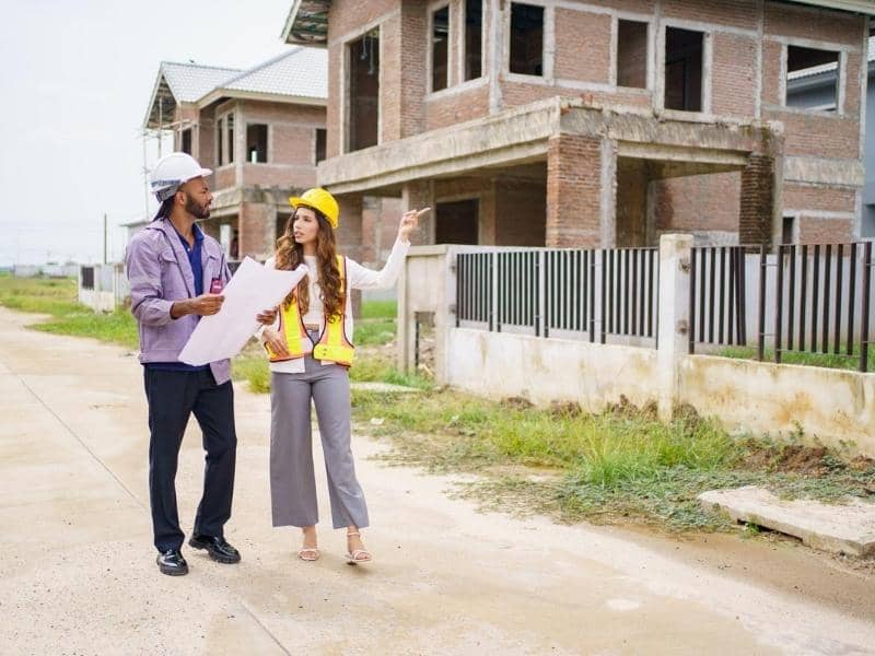
When to Order a Survey During a Development Project
The earlier a survey is ordered, the more useful it is. Here is when surveys matter most during a development project.
Before buying the land: A survey before closing confirms the property is what the seller says it is. It can uncover problems like odd boundary shapes, drainage issues, or other constraints that affect what the land can be used for.
Before applying for permits: A current survey gives the accurate data needed for a site plan that meets local requirements. It reduces back-and-forth with the permitting office.
During construction: Construction staking places physical markers on the ground based on the approved plans. These guide contractors on where to place foundations, driveways, utilities, and other improvements. It connects the plan on paper to what gets built in real life.
Before final recording: For subdivisions, a final survey confirms that the lots as built match the filed plat and that all property corners are marked and certified.
What Do Development Surveys Cost?
Costs vary based on the size of the property, the type of survey, and the complexity of the work. In Georgia, a topographic survey for a development site typically runs between $800 and $2,500. Construction staking for a home build generally starts around $500 and goes up from there depending on the scope.
These are small numbers compared to a typical development budget. Fixing a misplaced foundation, dealing with a denied permit, or settling a drainage dispute after construction is built can cost many times more.