How Land Surveying Supports the Transition From Rural Tracts to New Residential Communities
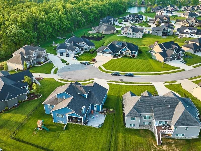
Land that sat quiet for decades is getting a second look. Old fields, timber tracts, and open acreage are now sitting in the path of new housing. Builders are moving further out because land closer to town is running out. But turning rural land into a real neighborhood isn’t simple. Land surveying is one of the first steps, and what gets done early shapes everything that comes after.
Why Large Acreage Properties Are Being Viewed Differently Than They Were a Generation Ago
Not long ago, a big rural tract outside town was mostly useful for farming or timber. Residential development wasn’t part of the conversation because the demand wasn’t there yet. That’s shifted. Towns are growing faster than nearby land can handle. Families want more space. Builders need land that’s still affordable enough to make a project work.
Those big rural tracts that nobody considered for housing ten years ago are now being seriously looked at. But before any of that goes anywhere, someone needs to know exactly what the land includes, where the boundaries are, and how the property connects to nearby roads and services. Land surveying answers those questions before plans start. That early information drives almost every decision that follows.
How Land Surveying Helps Turn Open Space Into Organized Neighborhood Layouts
Raw land doesn’t come with streets or lot lines already figured out. Someone has to bring order to open ground, and that starts with survey work that shows what the land looks like and how it can be laid out.
Land surveying gives planners and designers a real base to work from. It shows where the property sits, how it’s shaped, and how its parts relate to each other. From there, streets get placed, lots get sized, and open spaces go where they make sense. Without accurate survey work under that process, a layout that looks good on paper can fall apart when it meets the actual ground. Getting the survey right early means the neighborhood can actually be built the way it was planned.
Why Preserving Natural Features Matters When Communities Expand Into Rural Areas
Rural land has character that a standard suburban lot doesn’t. Old tree lines that have stood for fifty years. A pond sitting in a low spot. A stream cutting through one corner. Rolling ground that gives the land a natural feel. Those things are part of what makes rural land worth developing in the first place.
Smart planning works with those features instead of removing all of them. A tree line can become a natural buffer between sections of the community. A pond can anchor a central green space. A stream can become a walking path. Land surveying shows where those features sit and how they relate to the rest of the property. That gives designers a chance to keep them in the layout rather than treating them as things to clear away before construction begins.
How Land Surveying Helps Create Connections Between New Neighborhoods and Existing Communities
A new neighborhood without good connections to the area around it ends up feeling cut off. Residents need to reach schools, shops, parks, and other neighborhoods without it being a hassle. Roads need to tie into existing streets in ways that make sense. Trails and sidewalks need to link up with what’s already out there.
Here’s where land surveying helps make those connections work:
- It shows how the new property meets existing roads at its edges, so street connections get designed to real conditions
- It identifies where neighboring properties and public land sit, so trail links can be planned early
- It locates nearby utility connections so new neighborhoods tie in without gaps
- It gives planners the spatial picture they need to treat the new community as part of the broader area, not just a standalone project
Those connections, built into the plan from the start, are what make a new neighborhood feel like it belongs there.
Why Today’s Survey Work Influences How Future Generations Experience the Land
Early decisions in a development project don’t just affect the first people who move in. They shape how the community works for decades. A street laid out slightly wrong makes everyday life harder for years. A shared space placed in the wrong spot sits empty while people walk around it.
Land surveying done well at the start gives planners accurate information when those early calls get made. Streets go where the land supports them. Shared spaces end up where people will actually use them. Room gets left for future connections to roads and trails before it’s too late to add them. The people who move in ten or twenty years from now will feel the results of those early choices every single day, even if they never knew a survey was part of it.
Frequently Asked Questions
What role does land surveying play before residential communities are developed?
It provides the measurements and property information that planners, designers, and builders need before any development work begins.
Why are large rural tracts attracting residential development?
Growing populations and rising housing demand are pushing new communities further out into land that was previously used for farming, timber, or left as open space.
Can natural features affect neighborhood layouts?
Yes. Ponds, tree lines, streams, and natural ground shape how roads, lots, and shared spaces get arranged in a new community.
Who commonly requests land surveying services on large properties?
Landowners, developers, builders, investors, and engineers all rely on land surveying during the early stages of turning rural land into a neighborhood.
Does land surveying only help with current projects?
No. The information it produces supports future growth and long-term planning well beyond the first phase of development.